SCI received funding, via the Scottish Government’s Nature Restoration Fund, to investigate how erosion scars on the Allt Mor, a tributary of the River Spey, contribute to sediment build-up and flooding in Kingussie. With the imminent conclusion of the investigation, we have summarised our approach and findings below. Please read in full and download the reports at the bottom of the page if you are interested in finding out more.
Methodology
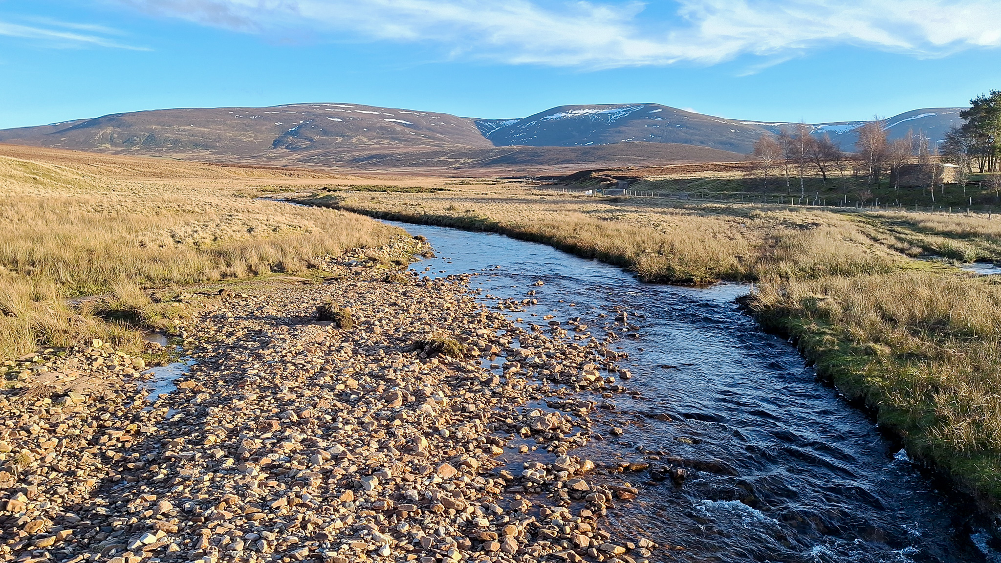
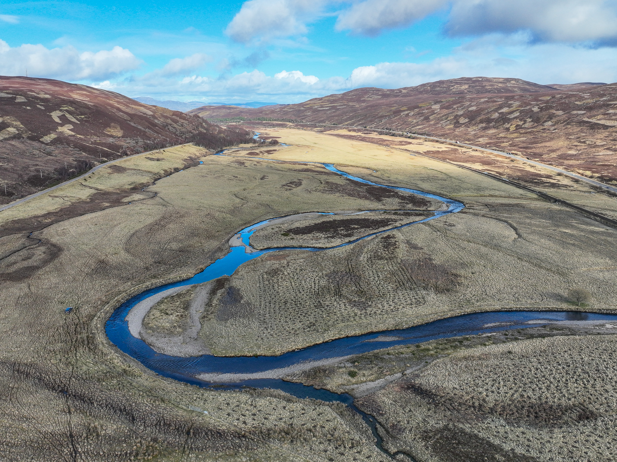
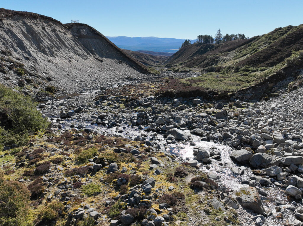
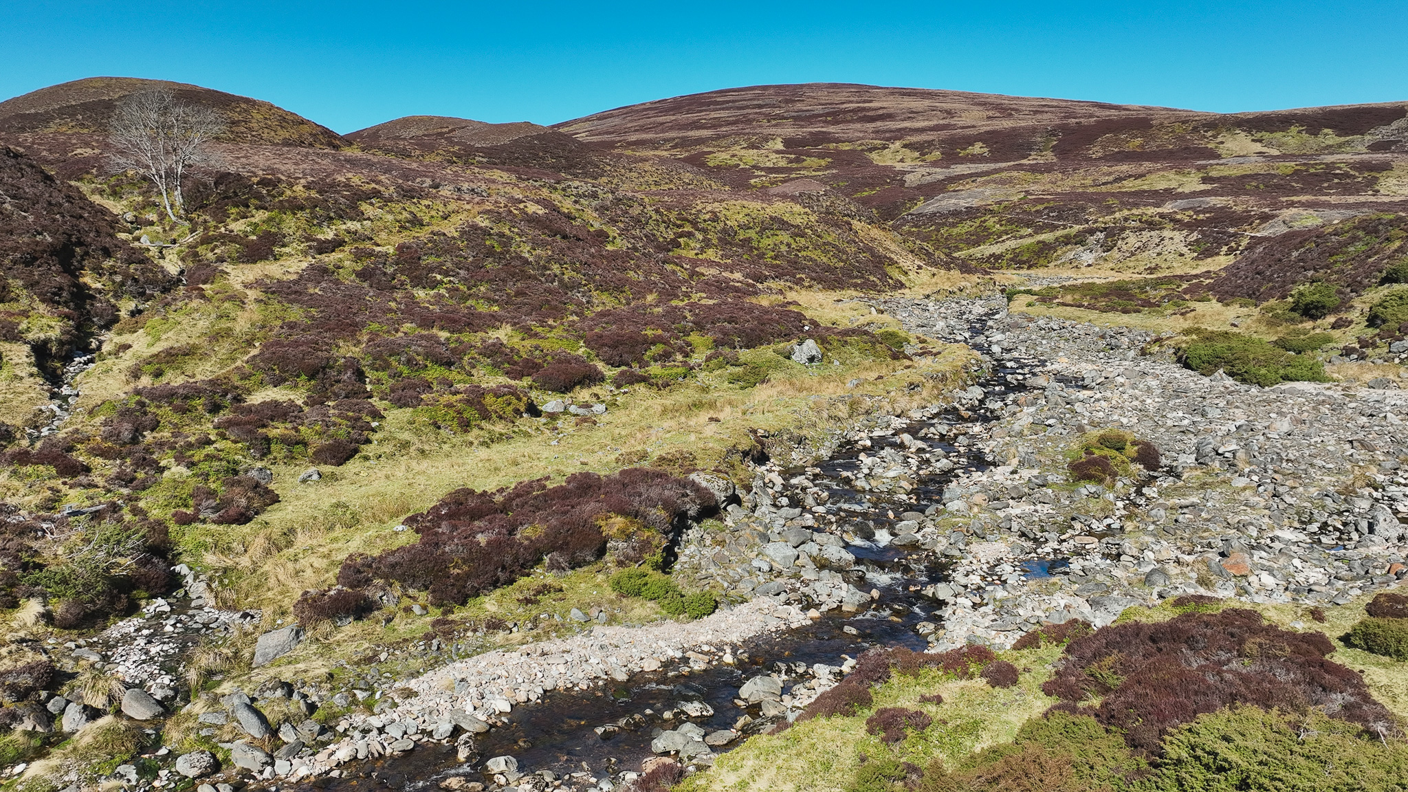
The Allt Mor is a steep fast flowing river rising in the Monadhliath before becoming the Gynack Burn, flowing through Kingussie and joining the River Spey. The investigation comprised four key elements:
- Collating existing studies to avoid repeated effort.
- Community consultation to help shape the direction of the project and inform the best way forward.
- Baseline surveys to understand current conditions.
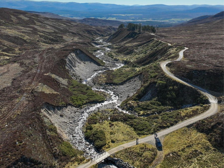
- Working with CBEC Eco-engineering to design and model a potential solution to stabilise the four most severe erosion scars, together with riparian vegetation recovery techniques. CBEC have estimated that 60-75% of sediment entering the Allt Mor originates from these four erosion scars.
Results and Outcomes
Following extensive examination, CBEC have proposed the following in order to reduce sediment input to the Allt Mor:
- Reprofiling the erosion scars to create a shallower slope angle (approximately 33°)and reduce gravitational and rainfall induced erosion.
- In addition, a bench would be constructed, using large woody structures and river-derived sediment (boulders, cobbles, gravels) at the base of the slopes to disconnect the erosion scars from the river. Rapid vegetation establishment on the bench would be essential for the design to succeed, as roots would help bind the bench structures and soil together.
CBEC have also considered the wider catchment, informed by ecological and technical surveys, commenting on both completed and planned interventions:
- A new deer fence is being installed above the erosion scar reach which will reduce herbivore pressure. However, the area within the fence is still grazed by sheep and so it would be imperative that livestock exclusion is prioritised alongside any future intervention to enable successful vegetation establishment.
- Prioritising peatland restoration in the Allt Mor catchment going forward will ensure that natural flood management benefits are maximised and would have a positive cumulative effect alongside other interventions to reduce flood risk.
It is important to note that none of the interventions above would be sufficient in isolation to reduce sediment transfer downstream to Kingussie.
Community Consulation Outcomes
Community consultation highlighted the need to look at the wider catchment, while also taking action downstream to reduce immediate flood risk. This resulted in the following:
- Pitmain & Glenbanchor Estates have committed to removing unstable trees along the riverbank that could cause blockages downstream in flood events.
- Network Rail and Highland Council are working together to coordinate dredging efforts in the Lower Gynack going forward and Councillor Russell Jones is liaising with Highland Council to influence upcoming dredging operations.
- Dredging of the sediment trap (associated with the flood alleviation channel) was also discussed. The sediment trap is visually assessed and can be emptied when it is 2/3 full, providing this falls out with salmonid spawning/ incubation season and is carried out during low flows. Pitmain & Glenbanchor Estates have told us that this will be done as and when necessary.
Conclusion and Recommendation
At the conclusion of the Allt Mor Erosion Scar Investigation, the Spey Catchment Initiative (SCI) has reviewed all of the reports, and taken into account the suggestions from the community engagement events, and identified the following concerns:
- Uncertainty over the scale of benefits from the engineering work in mitigating current sediment impacts. CBEC’s report states that overall sediment supply rates are estimated to decrease by 40–50% and could take up to a decade for this to be realised, albeit with approximately half of this improvement delivered immediately. However, the percentage reduction in sediment input, and timescale for realising the impact of the works downstream, would be dependent on the magnitude of flood events and the downstream movement of existing sediment in the system. Reducing sediment input upstream could take up to 10 years to translate into reduced flood risk downstream. It is important to highlight, therefore, that these proposals would ease/reduce the problem, rather than solving it completely.
- Risk of early failure posed by severe rainfall events in the vulnerable post-implementation phase. Maximising the reduction in sediment input to the Allt Mor hinges on rapid vegetation establishment and minimal flood damage which could compromise the integrity of the works.
- High cost estimate for delivery of over £820,000 to stabilise the erosion scars if implemented as designed, with additional ongoing monitoring costs. This estimate does not include ground investigation before construction works, or the costs of re-vegetating the area and associated livestock fencing. Accounting for all of the above, implementing the project could cost around £1 million.
- Lack of sufficient stakeholder support (from funders and the local community) for an implementation project at the high quoted cost estimates, combined with the uncertainty outlined above. There is however community support for immediate ‘quick wins’ and a catchment scale approach increasing targeted peatland restoration and riparian woodland.
Despite these concerns, the funding provided by the Scottish Government’s Nature Restoration Fund has been invaluable, allowing the SCI to fully investigate the concept of reducing sediment input upstream to reduce flood risk downstream, building on existing work and recommendations for the Allt Mor/ Gynack and making significant progress on key flooding issues.
After careful consideration of all of the above, the Spey Catchment Initiative’s Advisory Committee is recommending to its Board of Trustees that the SCI is not the appropriate organisation to take this project forward to implementation. CBEC’s design remains available as a long-term solution for other organisations to consider towards reducing flood risk and enhancing riparian habitat around Kingussie.
Allt Mor Investigation: Reports
CBEC Eco-engineering have studied the Allt Mor catchment and designed a potential solution to stabilise the four most severe erosion scars. CBEC have estimated that 60-75% of sediment entering the Allt Mor originates from these four erosion scars.
CBEC Allt Mor Erosion Scar Report
The following reports were produced during the investigation and informed CBEC’s work:
Additional data has also been gathered:
- Electrofishing
- Protected Species Survey
- Freshwater Invertebrate Sampling
Investigation Partners
Spey Catchment Initiative
Project Lead
Nature Scot
Investigation Funder
Pitmain and Glenbanchor Estate
Land Owner
CBEC
Lead Consultant
This investigation is also being supported by a number of organisations who have provided their expertise in carrying out surveys. These include:
- Spey Fishery Board
- University of the Highlands and Islands
- Adoxa Ecology
- Tracks Ecology